

GreenReport® Archive
TerraMetrics Agriculture uses satellite data to produce a series of “greenness” maps for the continental US that we call the GreenReport®.
We invite you to browse the GreenReport® samples below, then Contact Us to subscribe.
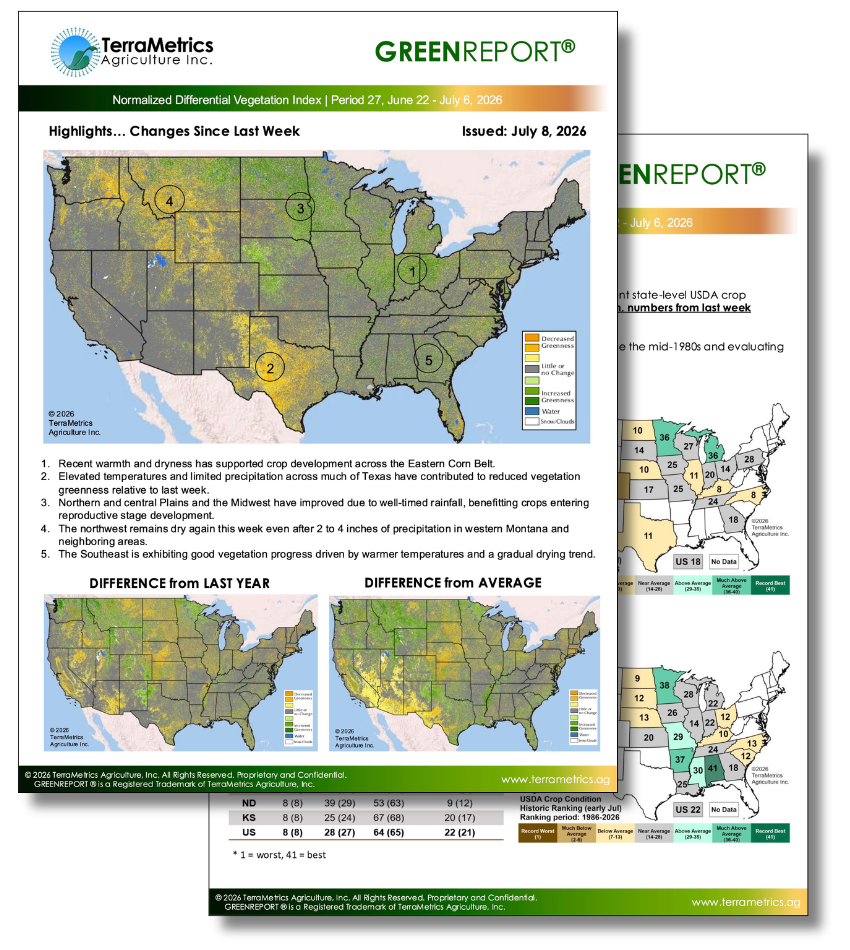
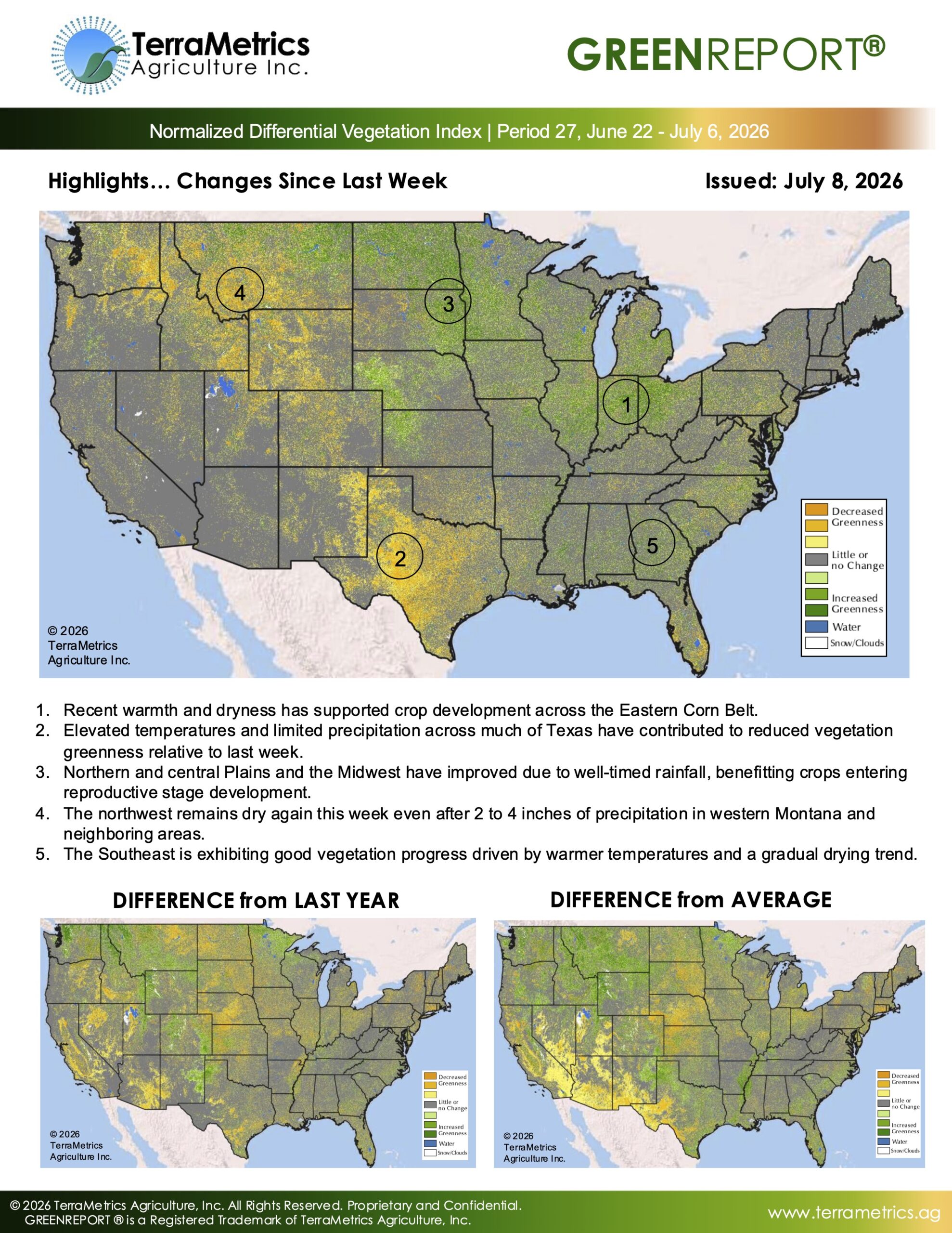
GreenReport ®
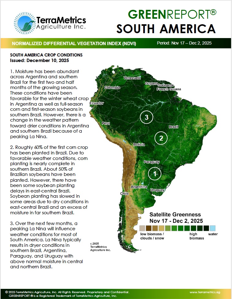
South America GreenReport ®
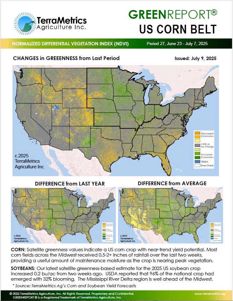
Corn Belt GreenReport ®
Wheat Belt GreenReport ®
